About this case study
Reduced rainfall, increased temperature and potential evapotranspiration
State and local governments
Advanced
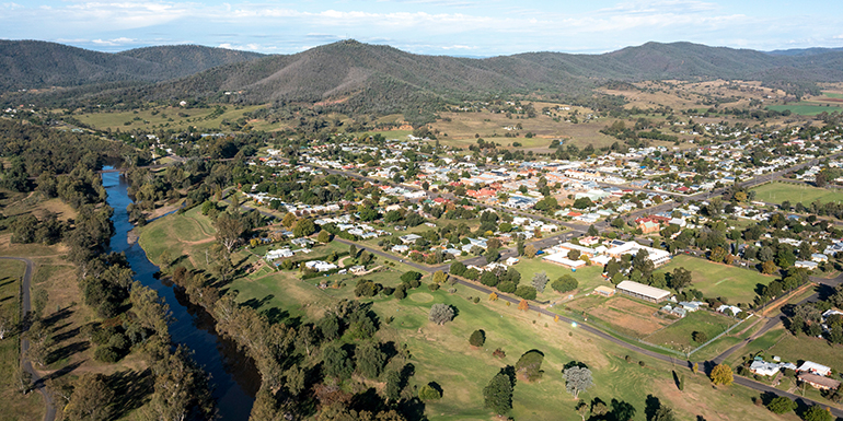
As one of the driest countries on Earth, water planning is critical in Australia. Draft regional water strategies are currently being developed for NSW. As a result, NSW is working with communities to explore water security challenges and options, and develop 12 regional (plus 2 metropolitan water strategies) that have been informed by NARCliM regional climate projections.
These strategies set out the approach to maintaining and building the resilience of the state’s water resources, including in response to climate variability and change. Richard Beecham, Manager of Water Modelling in the NSW Department of Planning and Environment, says that their role is to provide the expert technical advice needed to develop the strategies.
‘Our water systems need to be managed to meet the needs of the environment, regional towns, industries and agriculture,’ he says. ‘So we need to know their vulnerabilities - what we can expect in terms of rainfall, temperature and so on. NARCliM provides the best available data to understand future changes.’
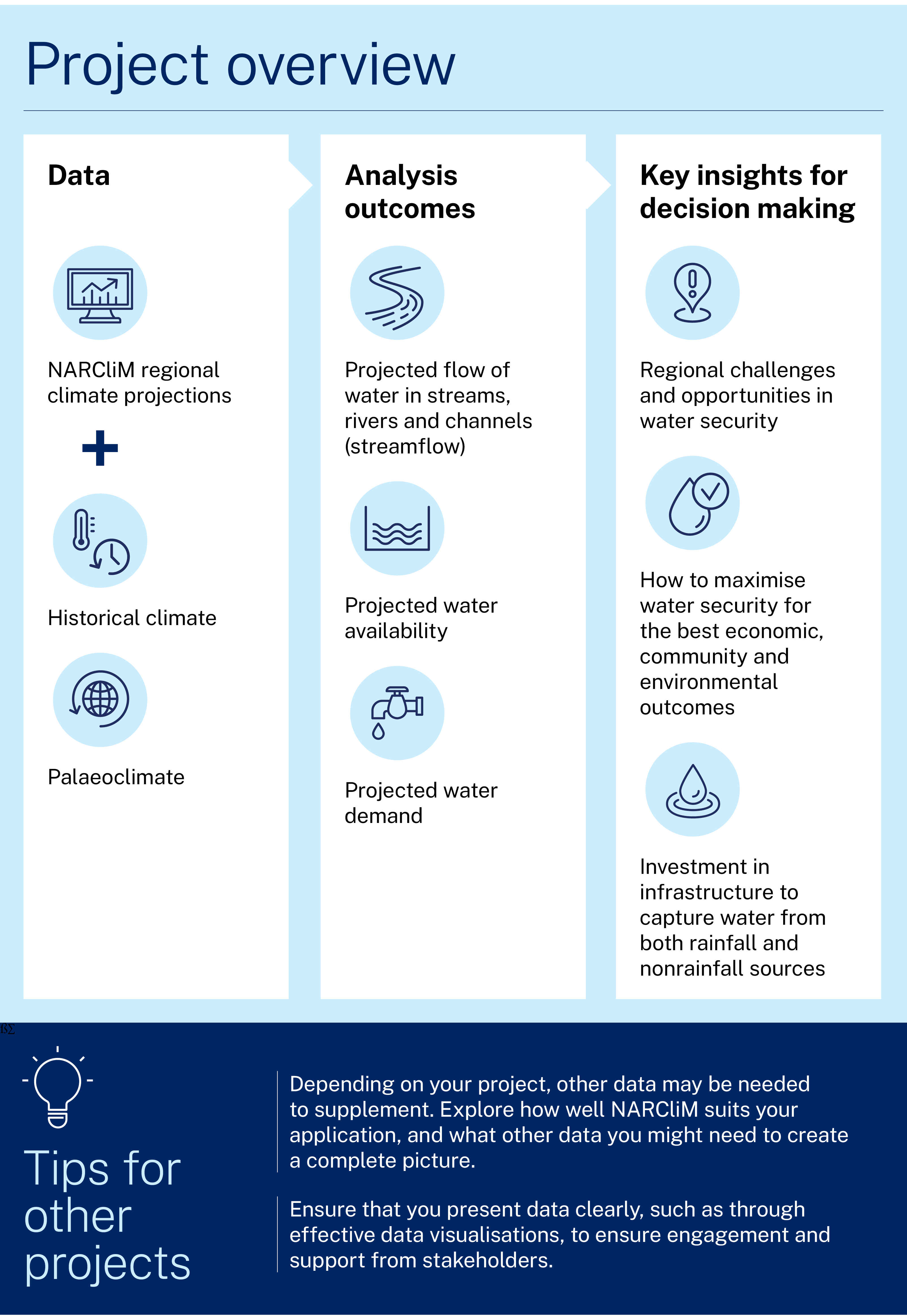
Project and outcomes
The NSW Department of Planning and Environment is building climate risk assessment into a wide range of planning processes, including regional water strategies.
Previously, NSW water planning has been done based on historical climate data of the past 130 years. But Richard explains that recent drought and floods in the past 2 decades have not followed the patterns of the previous century. He says:
We realised that we had to get ahead of the curve for strategic planning. We needed a better understanding of what’s going to happen in the future, if climate change means that the historic record becomes less useful as a guide.
Richard explains their 2-pronged approach to this:
The first aspect of our modelling is climate variability. This is critical because NSW climate is characterised by multidecadal wet and dry periods, revealed by historical records and by palaeoclimate information. The palaeo data, which reconstructs climate patterns for past centuries from evidence in the landscape, is crucial because 130 years is actually a short time in terms of climate drivers and patterns.
The second aspect of our modelling is climate change, which is what NARCliM provides.
Using these pieces together means we can extend the climate information that our water models use and look at the influence of projected climate change. We’ve stochastically generated 10,000 years of daily data at 2,000 NSW locations to see what we can expect for rainfall and evaporation, to tell us about our future water supplies.
To ensure that this approach was scientifically robust, we commissioned an independent review by an expert panel, which concluded that this approach of combining variability and change was consistent with best practice.
The team also found that they needed to take regional differences into account, because the drivers of water availability can vary across NSW, such as the occurrence of east coast lows. Richard says:
We looked at the frequencies of wet and dry periods and linked those to the key climate driver that is responsible for those sequences – for most of NSW this is the interdecadal Pacific oscillation. But research by University of Newcastle found that the main driver for climate affecting water availability for the south coast was actually east coast lows. So, we needed to build another model. We combined work from the Eastern Seaboard Climate Change Initiative with NARCliM to find out what happens if the frequency of east coast lows changes with climate change.
Mark Simons, Director of Climate and Strategic Projects in the department, explains what is now happening with the results of the modelling:
The purpose of the work is to inform regional water strategies. We are at the start of this process, where we are taking the information we have produced to engage with stakeholders and raise their awareness of the climate risks to water reliability and supply. We have developed a suite of draft strategy documents that show what we might see in the future, and therefore what we have to plan for.
The use of NARCliM1.0 allowed us to understand how climate change may influence water availability 40 years into the future. This is appropriate to inform a strategic framework, but in the next phase of the work we need to understand how to use climate change information to inform shorter-term planning and operational decisions, and this may require further refinement in our approach. Each region will need to understand what will happen in the future and start to take steps to address it.
Mark emphasises that the stakeholders are not just state and local government.
Water supplies affect everyone. Everyone who drinks or uses water in NSW is a stakeholder.
And it’s not just NSW. We are part of the Murray-Darling Basin – NSW rivers flow into South Australia and affect availability in Victoria. So, to develop the strategies, we have to understand the likely climate change outcomes beyond the state.
Our models give us the information we need to talk with the Murray-Darling Basin Authority, Sydney Water, Hunter Water, local councils, environmental groups, irrigators, industries, power stations, and so on. And for everyone to come together to plan effectively for the future.
Learnings and considerations
Richard says that NARCliM has been essential to their work because it has provided targeted, locally relevant data.
We are using scientific methods to look at future change and we want to use the best available modelling - for those interested in NSW, it’s NARCliM.
There are many global climate models, but their detail is limited for a region the size of NSW. They might have only 20 or 30 grid cells. And, for example, a grid cell that extends from Tamworth in inland NSW to Kempsey close to the coast can’t provide detail on a fine enough scale to guide future water use and infrastructure investment in towns and regions. It averages over too big an area.
Because NARCliM goes down to cells of just 10 kilometres, we can much better capture high spatial variability.
Richard also believes that the scientific integrity of NARCliM data will be important to the overall project. He explains, ‘Because water is a finite resource, it’s important that the data we provide to decision makers is robust and defensible. We can point to the NARCliM work as the best available current science.
However, Richard advises that care should still be taken in using NARCliM. He says:
NARCliM is a great dataset, but it’s up to you to determine its suitability for your application. Know its strengths as well as its limitations.
We understand what is important to water management. For example, we know that climate variability is critical. Because climate variability – particularly drought lengths – is not evident in the comparatively short time periods of NARCliM data, it limits us using it directly.
On temperature increase, NARCliM is going to give a pretty good indication. For rainfall, NARCliM is a line of evidence we can use in our modelling, but we would not rely on it solely. You are likely to need other data such as our stochastic modelling.
Mark also advises that clear communication of results is an important consideration. He says:
When presenting any information that comes from NARCliM you should describe the context, the choices you have made in modelling, and the uncertainties. For us, although we know that our climate is already variable, we chose the drier scenarios because we want to know what we might need to plan for in terms of extremes. We can then work with stakeholders to plan the way forward.
Case studies
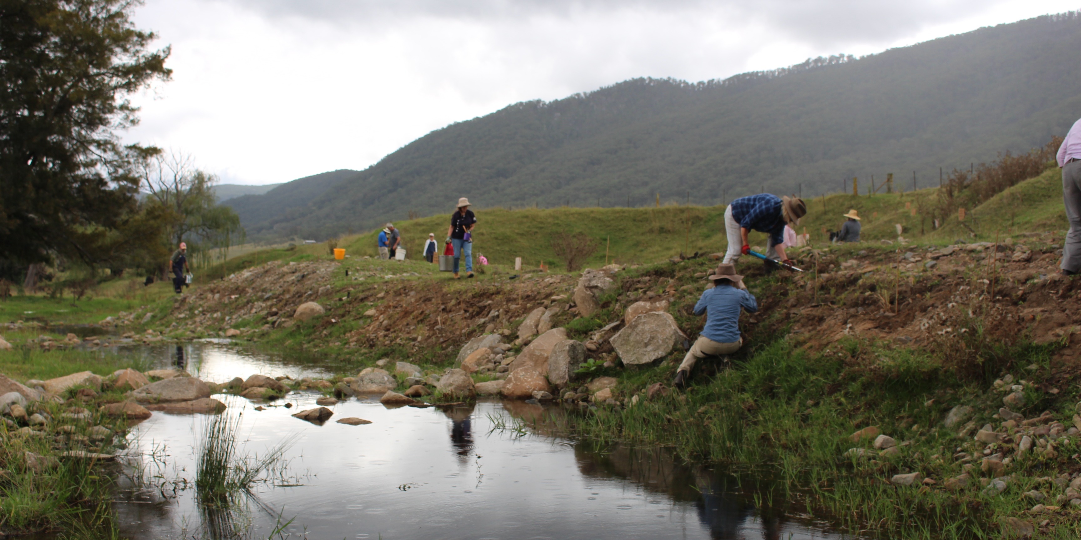
The Restore and Renew webtool provides simple, science-backed guidance to improve restoration projects across New South Wales. In the Hunter Valley, it is helping to rebuild climate-ready, genetically diverse populations of the River Red Gum.
The Yass Area Network of Landcare Groups is is using the Restore and Renew webtool to guide seed selection for their Climate Ready Revegetation Project.