About this case study
Heat
Local government, land and water managers
Climate smart design
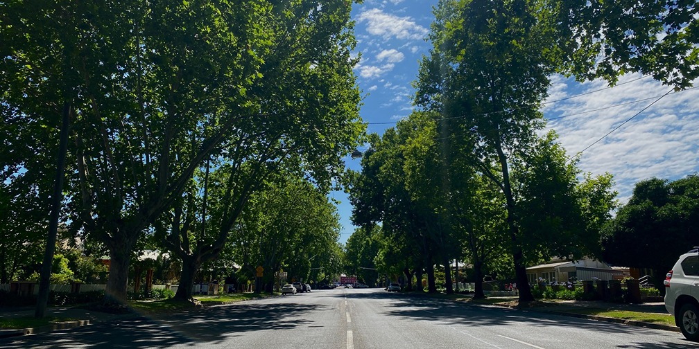
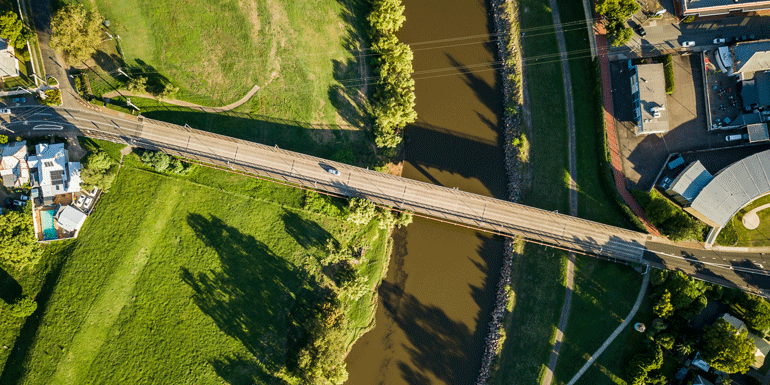
Information gathered at 16,000 feet is helping Wagga Wagga City Council create cooler places on the ground.
By setting a baseline of tree coverage and urban heat, we have set targets and can track improvements over time.
Jason Carroll, Environmental Monitoring Officer, Wagga Wagga City Council
The datasets gathered – across 27 suburbs, land use zones and road reserves – reveal insights into how trees can help communities adapt to hotter climates.
The climate of the Murray Murrumbidgee region is changing. According to AdaptNSW’s climate snapshot, the region will be about 0.6°C hotter in the near future, and around 1.9°C hotter by 2070. The number of extreme heat days is projected to increase, and the number of frost risk nights is expected to fall.
Increasing temperatures in the Murray Murrumbidgee could have profound impacts for human health, biodiversity, energy consumption and liveability.
Extreme heat can be mitigated by increasing urban trees – but with canopy coverage of just 10.8% across the local government area, Wagga Wagga City Council had lots of room for improvement.
With the help of grant funding from Local Government NSW, Council embarked on a mapping exercise that would build a strong evidence base and guide Council’s tree planting.
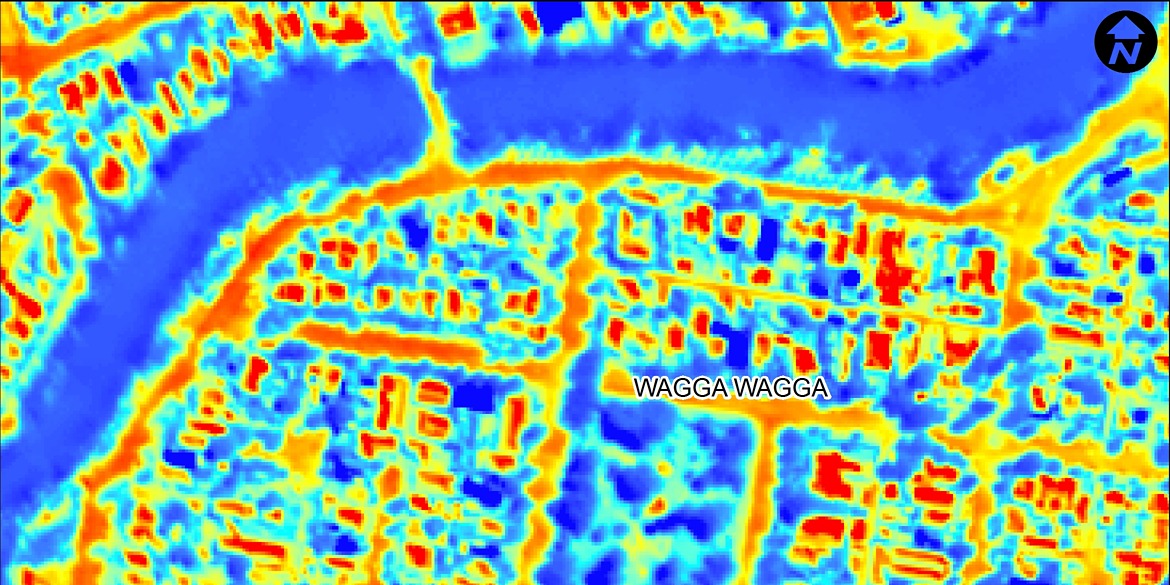
What did the mapping exercise reveal? Canopy cover proportions varied between 2% (in industrial and farming areas) to 16% (in older established areas and riparian corridors).
Council also overlaid canopy cover datasets with the Australian Bureau of Statistics’ Socio-Economic Indexes for Areas (SEIFA) to better understand the impact on communities most vulnerable to climate change – like suburbs with a high proportion of elderly people, young children, or people experiencing social disadvantage.
The starting point of this project was mapping the tree canopy and urban heat islands, which will hopefully lead to an urban cooling strategy - with objectives from cooler roofs to better street design - to help us adapt as our climate changes.
Jason Carroll, Environmental Monitoring Officer, Wagga Wagga City Council
Neighbourhoods with the lowest SEIFA index were mapped and cross-referenced down to the individual street level to identify those most vulnerable to heat extremes. The project team created a high-resolution web-based mapping tool to better analyse the data and directly target areas.
“We have been able to compare our urban areas to other cities with similar climates to see where we need greater canopy cover,” says Jason Carroll.
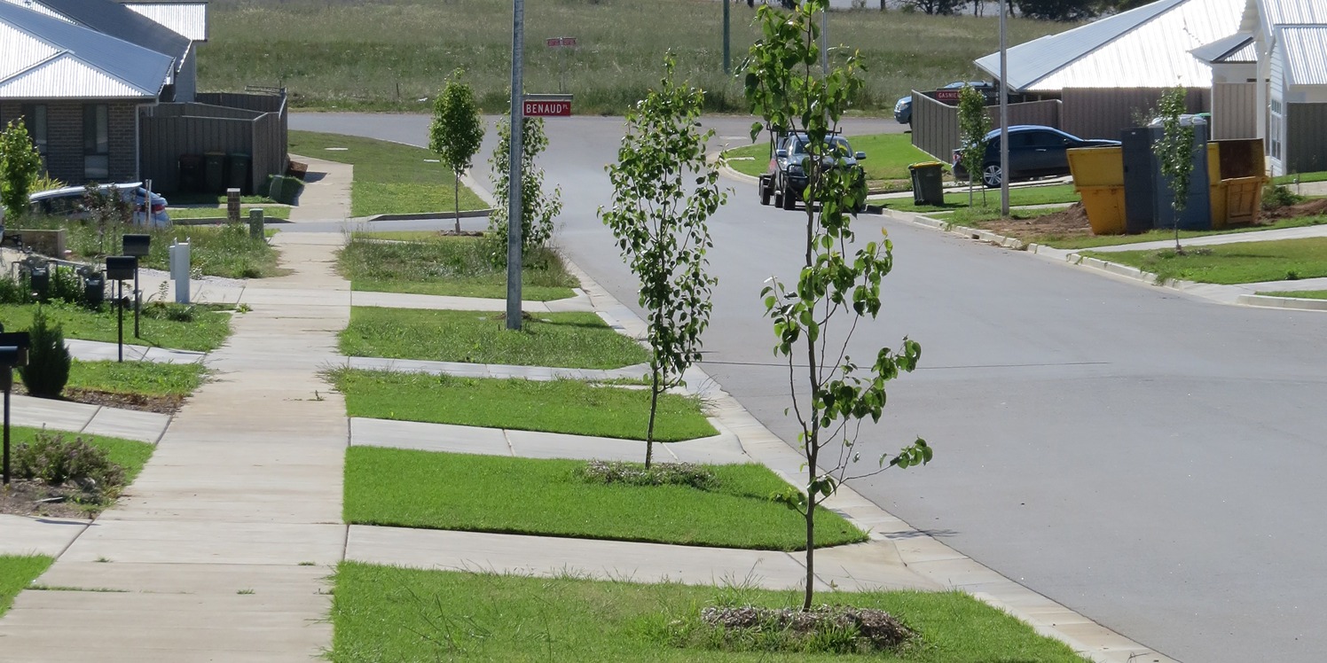
Using the initial data as a guide, 325 trees were planted in autumn and winter of 2021. These trees now line roadside reserves and active travel paths, enhance recreational areas and public open spaces in suburbs with low canopy cover rates, higher urban heat, and in neighbourhoods with low SEIFA index.
In January 2022, a survey of more than 330 residents revealed the broad community support for Council’s strategy. Residents were emphatic they want “more trees please”, with 91% of respondents noting that there were not enough trees in Wagga Wagga. Residents also understood the link between tree coverage and urban cooling with 98% agreeing that “planting more trees will keep our city cooler during warmer months”.
The survey uncovered overwhelming support for tree plantings and 245 respondents made specific recommendations of places they’d like to see more trees.
A series of council-led projects are now in the pipeline. These include an education program focused on climate change resilience, and the One Tree for Me campaign which aims to plant 65,000 seedlings in the local area – roughly one seedling for every resident – over six years.
A user-friendly interface with Council’s website will soon allow residents to "play around with the data to see the canopy cover and heat mapping in their street, suburb and house,” Jason says.
The mapping exercise will be repeated in five-to-10 years to evaluate progress towards the tree planting canopy target.
The project has also uncovered valuable insights into community attitudes to canopy cover, and provides an evidence base for future community conversations.
This project was proudly funded by the NSW Government with support from Local Government NSW.
Case studies
NSW councils are building climate risk into their business-as-usual planning and policies for the first time, thanks to products developed using NARCliM’s locally relevant climate modelled data.
Ensuring there’s enough water in the moat may not be a common challenge for those preparing for changing climate conditions.
Climate change creates a significant risk to infrastructure, people, and the economy. The impacts from climate change, including damaging weather events, has already cost the state an estimated $3.6 billion per year.