Climate change already affects us – rising temperatures and changes to extreme weather events are common in NSW. But what does the future hold? Climate modelled data of future climates are known as climate projections, and are the best tools we have to understand and prepare for climate change.
In his presentation at the AdaptNSW 2022 Forum, Chris Royal, Director Sustainability at Transport for NSW, reported that the impacts from climate change, including damaging weather events, have already cost the state an estimated $3.6 billion per year. To build more resilient transport infrastructure, he and his team have turned to locally-relevant climate projections, helping them better understand and manage climate change risks and opportunities. And he’s not alone.
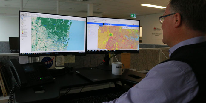
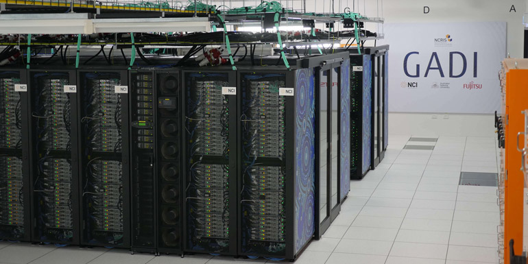
Climate modelling uses supercomputers to simulate different climates based on the processes and interactions that drive Earth’s climate. This enables scientists to explore how climate change may impact us in the future, so we can make plans to adapt. The results of climate model simulations are known as climate modelled data, and are presented in large datasets.
The NSW and Australian Regional Climate Modelling (NARCliM) project creates climate modelled data, including climate projections, at a level that enables users to understand the climate risks that each of NSW’s regions are likely to face. NARCliM data not only informs climate research, but has the local detail needed for climate policy, and planning materials such as climate risk assessments.
Across NSW, NARCliM data are being used to understand and prepare for our future climate. In addition to Transport for NSW, other examples of this work include identifying climate risks to infrastructure, assessing flooding hazard, adjusting bushfire management practices and understanding climate impacts on soil erosion.
Identifying climate change risks to infrastructure
The Cross-Dependency Initiative (XDI) analyses climate risks to infrastructure assets across the world to help asset owners understand the potential physical and financial impacts of climate change to their assets. The NSW Department of Environment and Planning has partnered with XDI to develop XDI NSW - a source of vital data focusing on NSW infrastructure assets.
XDI NSW brings together infrastructure owners and stakeholders from the NSW Government and private sectors to better understand climate risks to the state’s critical infrastructure. The project has created an online tool that provides data about hazard, exposure and vulnerability:
- Climate hazard data are sourced from NARCliM data, to make sure the analyses are suited to NSW climates. Thousands of individual critical infrastructure assets have been analysed for risks from flooding, coastal inundation, subsidence, bushfire, drought, extreme wind and heatwave impacts.
- Exposure data are sourced from census data and floodplain modelling, to provide information such as location and elevation.
- Vulnerability data are sourced from organisations that manage the assets, to provide information such as building type and construction materials.
Risk data from the XDI NSW project enable key decision makers to direct attention to assets and locations that need it most. Climate risk assessments can contain some subjectivity or bias, but, by using technology such as the XDI software, we can integrate objective climate modelled data to improve the rigor of assessments.
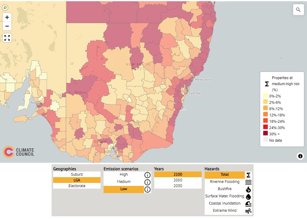
Leveraging this capability, the Climate Council used XDI software to analyse NARCliM data for their Climate Risk Map of Australia. The map enables users to visualise climate hazards under different emissions scenarios down to the suburb level. It includes hazards such as riverine flooding, coastal inundation, bushfires, extreme wind and flash flooding.
A key outcome of XDI is understanding how climate risks and opportunities affect connected and related assets and sectors, and how asset owners can work together to reduce risk.
At times, assets are vulnerable to the same hazard. For example, a telecommunication company and power company are likely to have assets close to one another, which are exposed to the same climate risks, such as flood.
Sometimes, a risk to one asset has a flow-on effect on another asset. For example, a water company may rely on a substation that is in a bushfire zone, and impacts on the substation will have flow-on effects to the water company.
XDI helps to identify these dependencies, revealing opportunities to collaborate across sectors to build mutual climate resilience.
XDI NSW is available to all NSW Government agencies and local councils through the XDI NSW project. To request access, please email: [email protected]
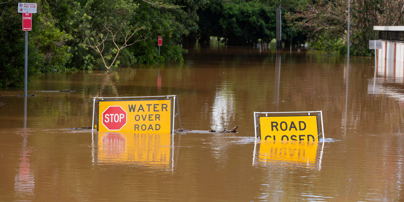
Assessing flooding hazard
Flooding is estimated to cost the NSW economy an average of about $250 million per year. The effect of climate change on rainfall patterns may worsen flood hazard. This could have profound impacts on communities and infrastructure. To adapt, we need to understand these projected changes and the risks they present both now and into the future.
To provide detailed flood simulations for various future climates in the Gwydir River Valley, researchers from the NSW Department of Planning and Environment used NARCliM data with an advanced flood model. This enabled them to simulate flooding time series over many decades and for several plausible climate scenarios. Understanding a range of plausible future climates helps to make better informed decisions and planning. Dr Michael Hughes, Principal Research Scientist on the project, said:
The lessons learnt from this new approach are being applied across other valleys in New South Wales to steadily build regional-scale future flood-hazard risk profiles to inform adaptation.
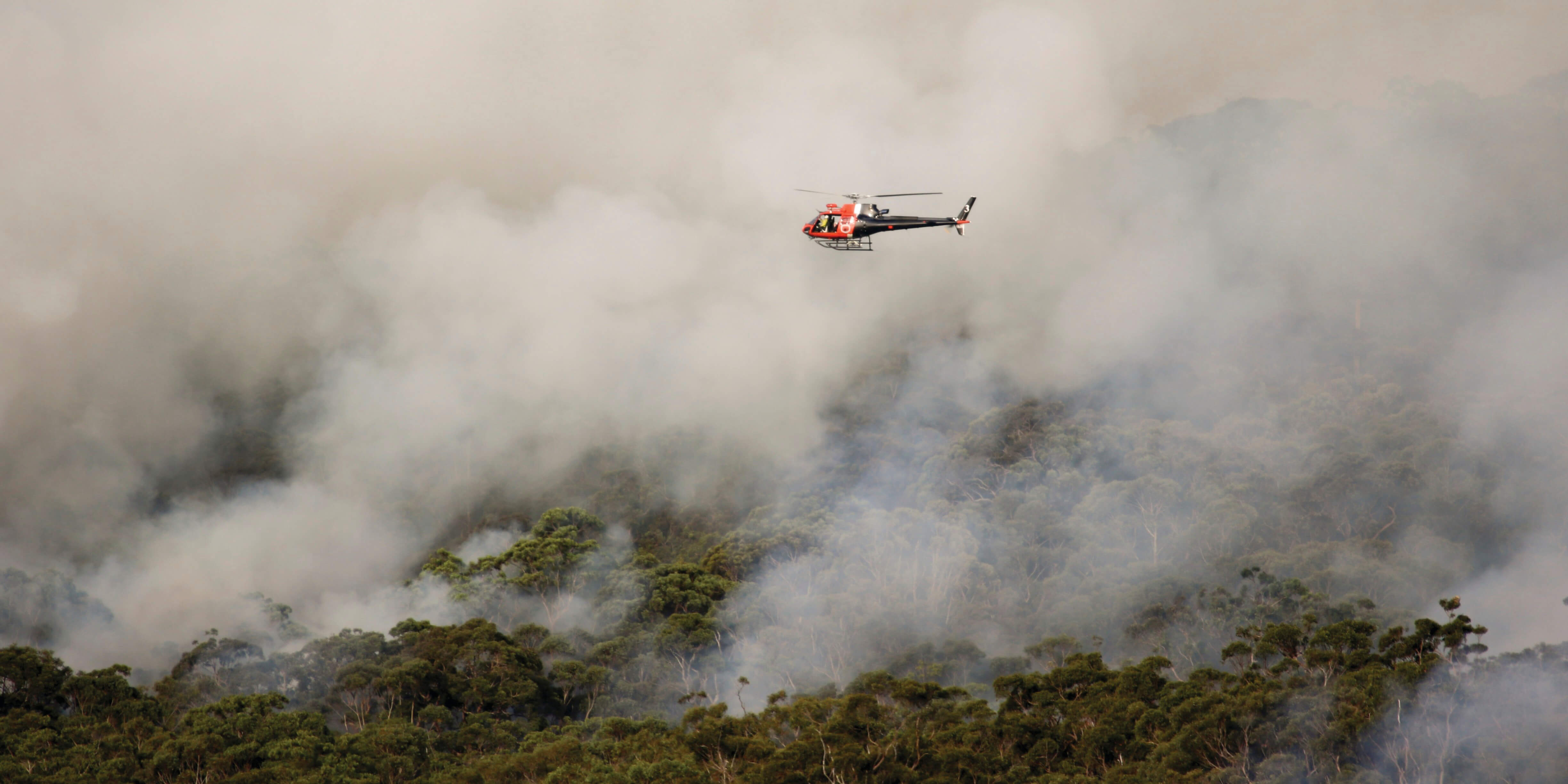
Adjusting bushfire management to reduce future risks
Fire is a natural and important part of Australia’s environment. But the unprecedented 2019–20 bushfire season clearly showed that we need new tools and approaches to manage bushfires in a changing climate. Dr Hamish Clarke, Lead Researcher at the NSW Bushfire Risk Management Research Hub, said:
If we’re going to live with bushfire, we need to understand it. In a warming world, that means having access to the best climate change information to inform models of future bushfire risk and our options for managing it.
The Hub combines historical fire data and NARCliM climate modelling to help us understand how fire behaves in NSW, and how it is likely to change in response to climate change. These insights can be used to develop practical tools that help mitigate future fire risk, such as the Prescribed Burning Atlas. The Atlas shows climate change impacts on the effectiveness of prescribed burning, so that fire managers can develop the best strategies for their region.
Understanding climate impacts on soil erosion
Climate modelling can also help us understand how our soils and landscapes are likely to change in the future. Data on changes to rainfall patterns provide insights into the severity and duration of future droughts, which can lead to dry, bare soils that are vulnerable to erosion.
Periods of intense rainfall, especially after drought or bushfire, increases this erosion risk. These changes in erosion have significant impacts to natural environments, agricultural land and water quality. For example, heavy rainfall after the 2019–20 bushfires washed ash and loose soil into many waterways, reducing water quality and affecting the plants, animals and communities that rely on those water supplies.
The NSW Government funded research into the risks that climate change poses to NSW soils to help policy and decision makers make more informed planning and management decisions. This work used NARCliM data to identify how climate change might affect soil erosion across NSW regions. The results showed that areas with steep slopes and high rainfall erosivity – such as the mountainous regions of the Great Dividing Range – will be the most impacted.
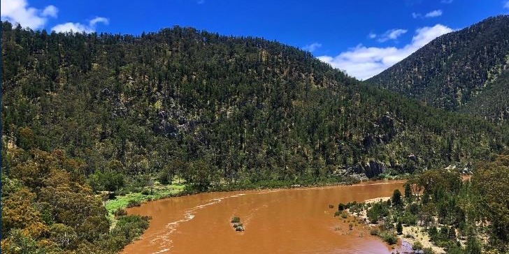
Erosion in these areas can be severe. For example, in early 2022, intense rainfall caused extreme erosion and landslips in the NSW’s north coast region. These events damaged homes and infrastructure, and cut off roads, leaving communities stranded. Using climate and erosion modelling, we can estimate future changes in rainfall erosivity and erosion risk and develop mitigation strategies to manage the risk and better protect our environment and communities.
Climate modelling helps us better prepare for our future
Climate modelled data – including climate projections – are the best tool we have to understand and prepare for our future climate.
The NSW Government continues to invest in climate modelling under the NARCliM project, to provide the state with robust data that are built on the best-available science and the local features of our regions. The next set of NARCliM data is being developed. It will provide finer-scale climate projections for all NSW regions and incorporate the latest available global climate models and emission scenarios.
Related news

The NSW Government hosts three events for Climate Action Week Sydney in March 2025
The NSW Department of Planning and Environment is joining NCI as a Major Collaborator
As Australia’s climate changes, we must consider how separate risks may converge to create compound events.