About this case study
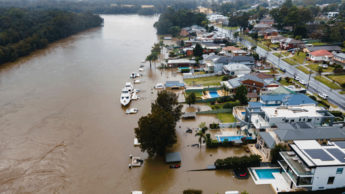
Increased temperatures, extreme events, reduced rainfall
State government
High
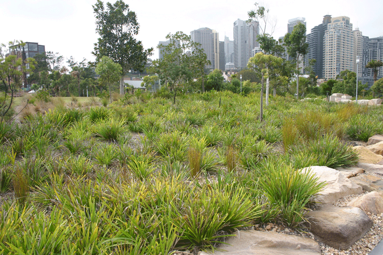
The role of the Greater Cities Commission (GCC) is to coordinate and align the planning that will shape the future of the Six Cities Region, which brings together the Lower Hunter and Greater Newcastle City, the Central Coast City, the Illawarra–Shoalhaven City, the Western Parkland City, the Central River City and the Eastern Harbour City.
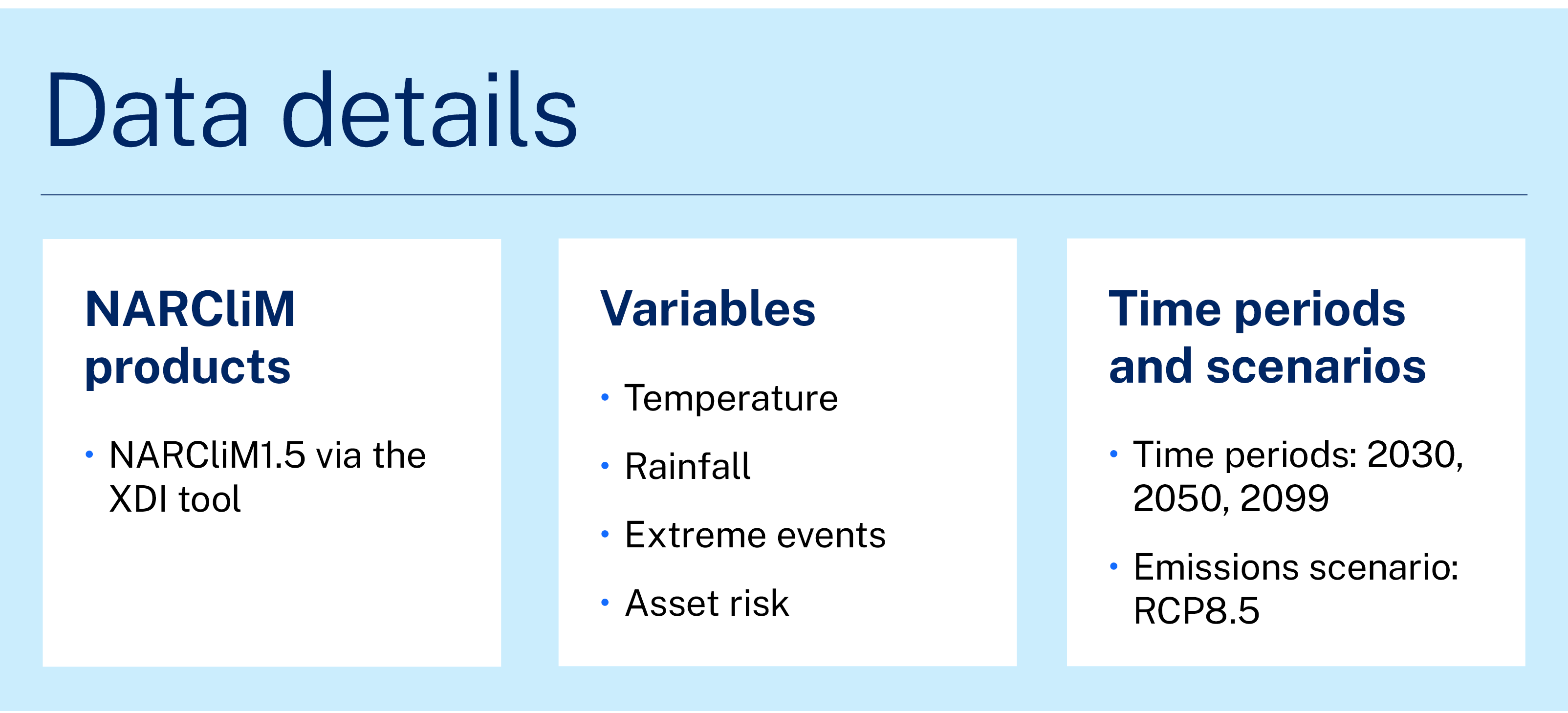
The GCC are using a tool that applies NARCliM regional climate projections to assess the socioeconomic risks of climate change for the region. The Cross-Dependency Initiative (XDI) tool is a piece of online software that provides climate risk and adaptation analytics that enables planners and decision makers to more effectively and efficiently assess the risk that climate change presents to assets, such as buildings or infrastructure.
Dr Nicola Nelson, Director of Research in Thought Leadership and Engagement for the GCC, explains the importance of NARCliM projections for their work. "The NARCliM projections are such a valuable resource for NSW to use to assess climate impacts across the Six Cities Region.
Having other agencies using NARCliM datasets also means there’s consistency around the datasets being used and comparative results, which is important when these are being used to inform investment decisions across government.
We are looking at all the weather and climate-related risks across the region, and their potential impacts on critical infrastructure and communities. Most of the climate change risks for the region are well known, especially floods and fire, but being able to quantify the cost and probability of impacts is the real strength of the XDI tool.'
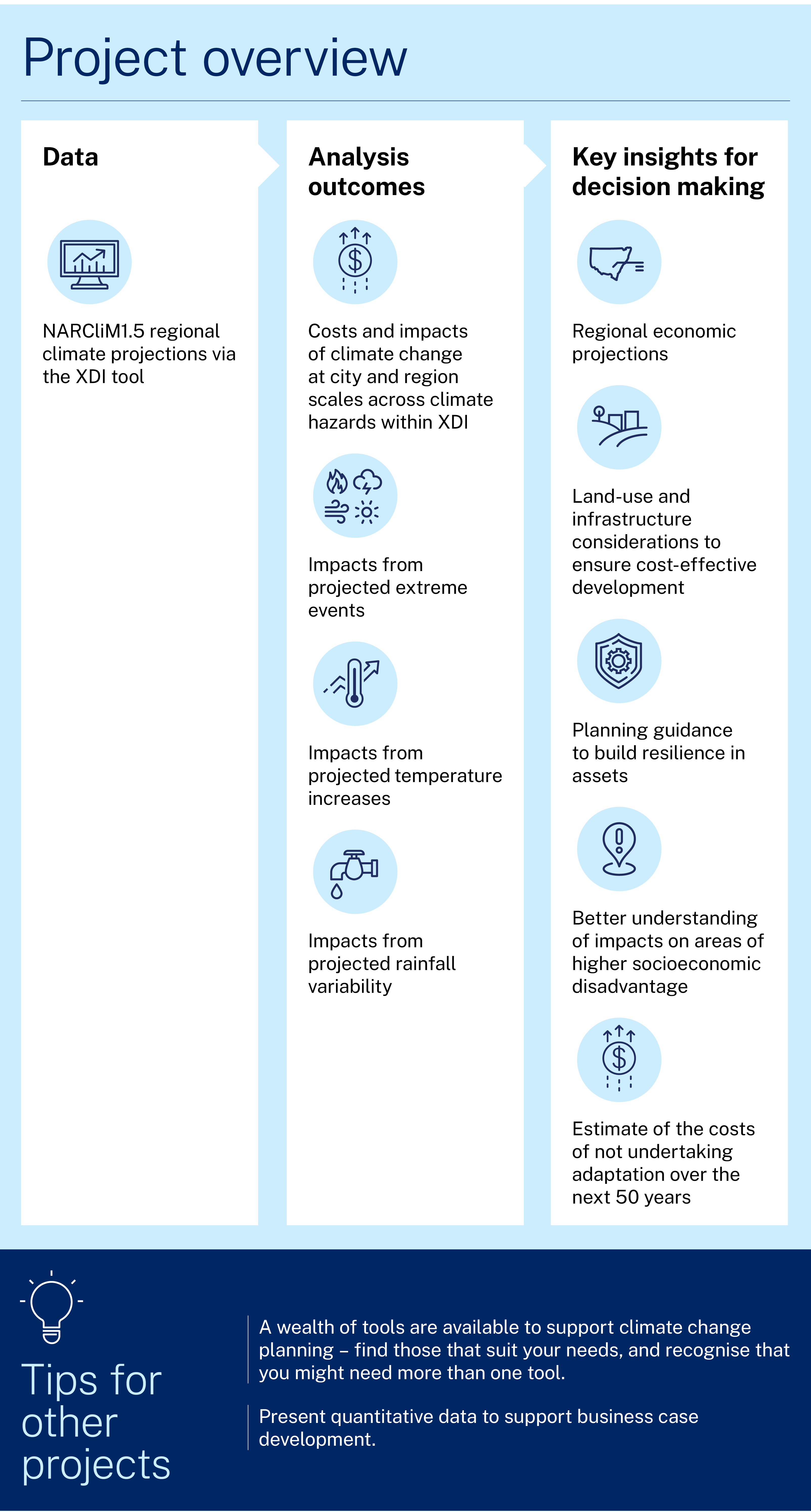
Project and outcomes
The GCC partnered with the Office of Energy and Climate Change (OECC) to generate a view of climate risk across the Six Cities Region using NARCliM1.5 projections via the XDI tool. NARCliM1.5 projections offer users 2 emissions scenarios – RCP4.5 and RCP8.5. The analysis used RCP8.5, a high-emissions scenario which assumes global efforts to reduce emissions are not effective.
High‑emissions scenarios, such as RCP8.5, are important to consider in land use planning, as it’s not possible to know what the future holds in terms of the level of greenhouse gas emissions and support for reducing them. If we only consider lower emissions scenarios, we may not effectively plan for more extreme conditions which still may eventuate.
The collaboration with OECC and the XDI team is part of the first stage in a proposed 3-stage program of work involving:
- a high-level regional analysis to identify and quantify risks
- more detailed analysis to drill down into high-risk areas
- identification of adaptation measures and engagement with communities.
The GCC in-house data analytics team is working closely with the XDI team to translate the outputs from the XDI tool into the regional information needed to inform GCC plans.
Nicola explains that they are aiming to understand the cost of investment required to adapt:
The ultimate aim of this work is to understand the cost of adaptation versus the cost of inaction. This will help inform future business cases for investment and help to identify new investment pathways. If we don’t start to build the case for resilience now, then the costs of adaptation may be even larger down the track.
This work leverages and supports the implementation of the NSW Climate Change Adaptation Strategy and other key government strategies including the Future Transport Strategy and State Infrastructure Strategy. Nicola says the research analysis can become embedded in decision making in various ways:
We can include the principles in guidance and planning. We can make recommendations and promote climate change considerations to local government, industry and communities.
Learnings and considerations
Planners and decision-makers need access to trusted information to inform strategic plans. Nicola believes that various tools are needed for planning projects that consider climate change. She says:
It’s a complex area and there’s no silver bullet. Agencies in NSW are fortunate to have a good suite of tools and guidance documents available, and we’ll be looking to leverage these for the next stages of our research program.
What has been lacking are quantitative tools [on climate change impacts] like NARCliM and XDI to support investment decisions. Qualitative information alone is not enough to build the case for large investments in adaptation at city and regional scale.
My advice for others doing such projects is that we should leverage the climate change expertise we have through the NSW Government and local universities. Agencies should be adopting similar approaches to assessing climate risk and adaptation planning to enable more consistent evaluation and build a more collective understanding of what needs to be done to increase resilience across the state.
Nicola has worked with XDI since its inception in 2011 and has seen the tool evolve. She says:
The XDI tool has evolved significantly since it was developed for the water industry. It now houses all critical infrastructure data and can assess broader socioeconomic risks. It’s a particularly effective communications tool that allows you to demonstrate the level of risk, and also to see how the risk reduces when you introduce adaptation responses.
This helps us to translate the science into planning and investment decisions, which is where the real challenge lies.
Case studies
NSW councils are building climate risk into their business-as-usual planning and policies for the first time, thanks to products developed using NARCliM’s locally relevant climate modelled data.
Learn how NARCliM climate projections are being used by various NSW sectors to understand and adapt to climate change.
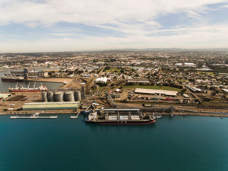
Climate change creates a significant risk to infrastructure, people, and the economy. The impacts from climate change, including damaging weather events, has already cost the state an estimated $3.6 billion per year.